

El Nino is coming. A story in the Oregonian describes what El Nino is and what its usual effects are.
An El Niño event occurs when central and eastern tropical Pacific Ocean temperatures become unusually warm, shifting weather patterns across the globe. Historically, El Niños have caused severe heat and droughts in parts of Asia and Australia, warmer and drier conditions in Canada and the northern United States and heavy rainfall and flooding in California and the southwest U.S.
Ten days ago the National Weather Service Climate Prediction Center said that there’s a 90 percent chance the upcoming El Nino will be a very strong event in the fall and winter of 2026-27. And a 69 percent chance it will be the strongest El Nino event ever recorded.
The CPC Official ENSO outlook, which synthesizes multiple models from North America and abroad, indicates El Niño will continue to strengthen through the end of the year [Figs. 6-7-8]. During the October-December 2026 season, there is a 69% chance of a historic event that would exceed the strength of previous El Niño events dating back to 1950 (+2.5°C or more for a 3-month RONI value). With an event of this magnitude, the chances of experiencing impacts consistent with El Niño are larger, but they are not guaranteed (see CPC outlooks for probabilities of seasonal anomalies). In summary, El Niño is strengthening, with a greater than 90% chance of a very strong event during the Northern Hemisphere fall and winter 2026-27.
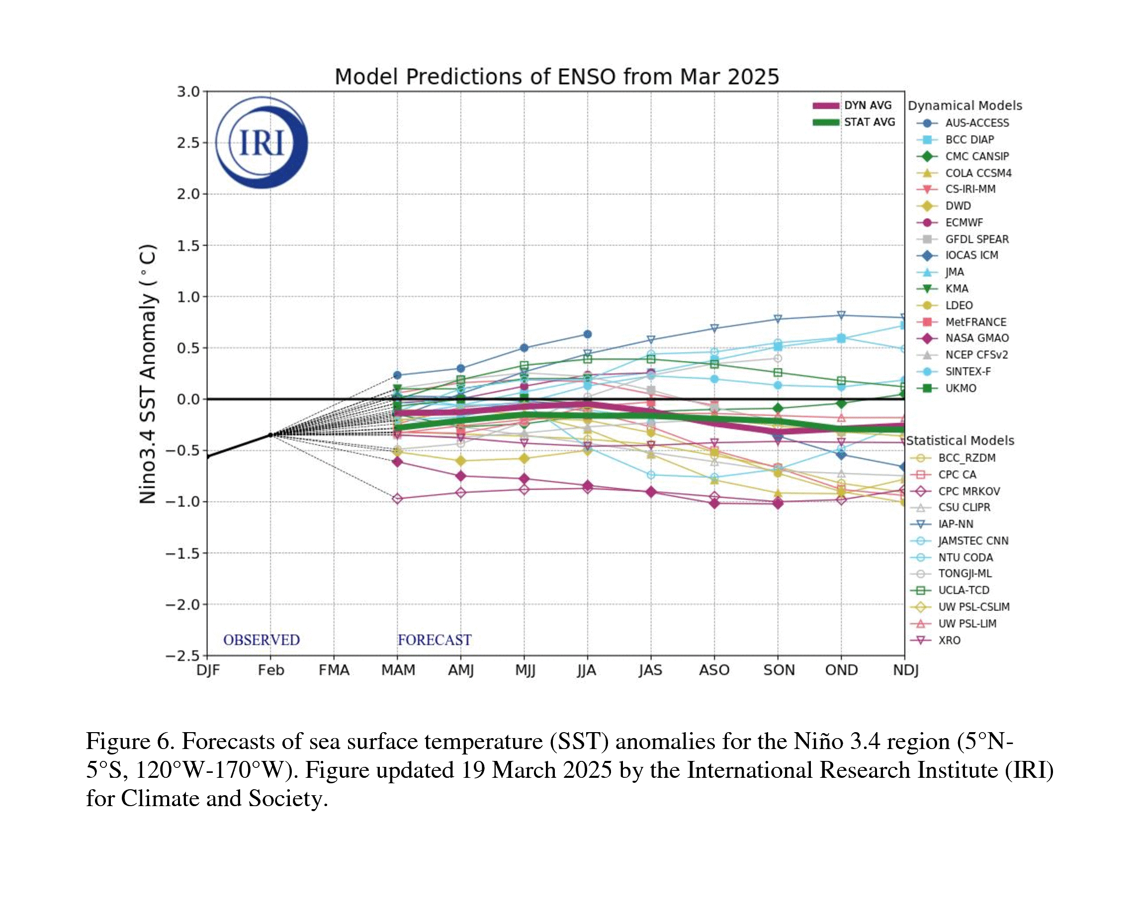
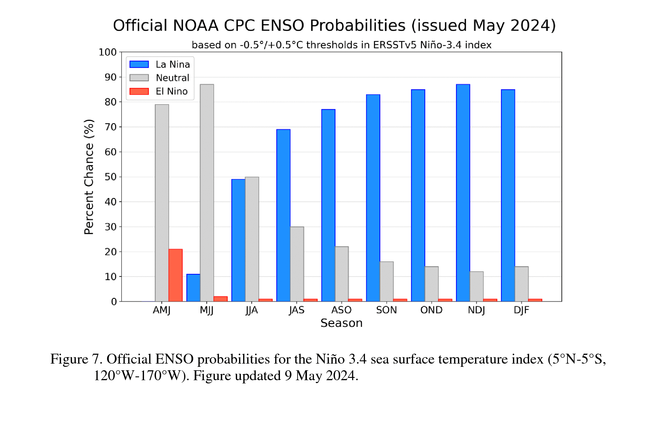
![-8]](https://www.cpc.ncep.noaa.gov/products/analysis_monitoring/enso_advisory/figure08.gif)
So what does this mean for Oregon?
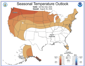
The three month forecasts of the Climate Prediction Center indicate that Oregon will likely be warmer than normal, while there’s either an equal chance of drier or wetter conditions, or somewhat wetter. These are the temperature and precipitation maps for October – December 2026. The darker the brown color, the greater the chance of warmer than normal temperature. Most of Oregon has a likely chance of this.
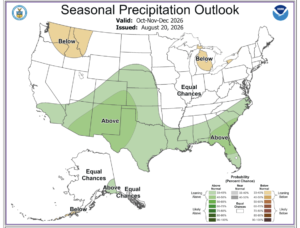
This is the October – December precipitation outlook. It shows an equal chance of wetter or drier than normal precipitation for all of Oregon except the far northeast corner, which is expected to have below average precipitation.
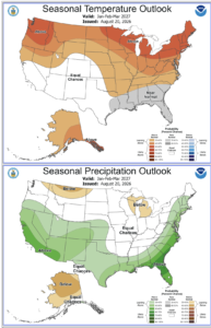
The January – March 2027 outlook is roughly similar, though the southern half of Oregon shows a chance of higher than normal precipitation.
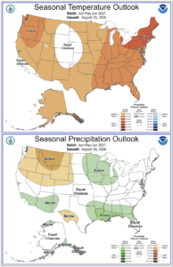
The April – June 2027 outlook is for above normal temperature in virtually all of Oregon, along with a decent chance of below normal precipitation.
However, climatologists have been saying that if the upcoming El Nino is truly extremely strong, and especially if it is the strongest ever, there’s no comparable historical data to predict what the effects will be. So while Oregon likely will be warmer than normal (that’s the hallmark of El Nino), we could either be inundated with large amounts of precipitation and atmospheric rivers — or we could face drought conditions. Or something in between.
That’s how climate change operates. When “normal” is far removed from what is happening now, all bets are off as to what the exact effects will be in a given area. All we can be sure of is that the past isn’t a reliable guide to the future, because of human-caused global warming.
Oregon’s snowpack probably will suffer in late 2026 and early 2027. Even if precipitation is normal, warm temperature will ensure that more of it falls as rain rather than snow at higher elevations.
Discover more from Hinessight
Subscribe to get the latest posts sent to your email.